 |
This land is amazingly beautiful and diverse. After a week of debate, research and getting feedback from experienced PCT hikers on FaceBook, I decided to tackle the last bit of section "D" and some of "E" for 3 reasons:
1- There are no dog restrictions on these sections, which means my little Booboo (aka "One Gallon") could come along.
2- The highest elevation is barely above 6k feet, hopefully keeping me under the snow line. This has been a very wet winter in LA, which means heavy snow in higher elevations. Also, more water in lower elevations, which make it a perfect time to hit those areas of the trail. Water is abundant in places that are usually bone dry.
3- Logistics. I really wanted to do section A and start from the southern terminus, but honestly, I was a little overwhelmed trying to get to there with pup from LA using public transportation. Everything about this trail is very different from the AT, which I am more familiar with. This was the best choice for me right now and I am certain that I will hit section A sometime in the future.
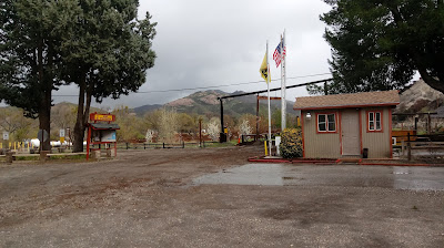
Heading only 45 minutes North of Burbank, I parked hotel Prius at the Acton KOA. For a day and a half I learned and practiced some knots, practiced setting up my new tarp as a shelter, scotch guarded some items, conditioned my boots and sorted home made dehydrated food before I started walking north. I didn't have a rigid mile count in mind, but just an idea of my ending point. I contacted a "trail angel" (a volunteer available to help hikers) in that area and we planned my ending point in order to determine a pick up location. She would drive me back to hotel Prius in time for me to make my daughter's school performance.
Although it would have taken a more disciplined and experienced hiker much less time than what it took me, I learned a lot in my first solo hike. I learned about me as a hiker and about the terrain I was covering. Here are my memories from my trek. I hope you enjoy them and they encourage you to head outside and enjoy nature.
You can find detailed maps and elevation profiles of the terrain I covered in PDF (last miles of section D and most of section E) here.
You can plan your own hike like I did (from Acton KOA to Hiker Town) here.
Day 1- Fri. Feb 25- Leaving the KOA
Day 2- Sat. Feb. 26.- Vasquez Rocks and Hiker Heaven
Day 3- Sun. Feb. 27.- Walking with a new friend
Day 4- Mon. Feb. 28.- A fair weather camper
Day 5- Tue. Feb.29 .- Cold mud to hot rocks
Day 6- Wed. Mar. 1.- To Casa de Luna
Day 7- Thu. Mar. 2.- Vacation vs. Challenge
Day 8- Fri. Mar. 3.- Can I do it?
Day 9- Sat. Mar.4.- To Hiker Town!
Day 10- Sun. Mar. 5.- Back to the city
Base weight and other info


No comments:
Post a Comment